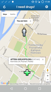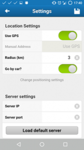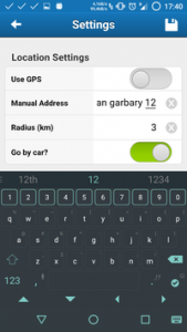
This is an application for finding the nearest pharmacy locations in the Wielkopolskie Voivodeship, Poland. You can select the search radius and the method of transportation.
The project is no longer being developed.
The project is designed to find the nearest pharmacy (and possibly several alternatives). The user’s position can be determined using the device’s built-in GPS or based on a manually entered address. Results are displayed on Google Maps, and a route is drawn to the nearest pharmacy. Users can also narrow their search by specifying a maximum radius in kilometers. The application also allows the selection of a mode of transportation – car or on foot – and depending on the choice, plots a route using only public roads or considering dirt roads, paths, sidewalks, etc.
Client (Android) – Sencha Touch 2.4.2 Framework (JavaScript), Google Maps API, Cordova (for building apk file)
Server (platform-independent) – Node.js (JavaScript), ExpressJS (for making client-server communication easier)